Maikidou-Poutrino, Dafni. "The Isiac Cults and Religious Connectivity along the River Strymon." CHS Research Bulletin 12 (2024). https://nrs.harvard.edu/URN-3:HLNC.ESSAY:104824974.
Early Career Fellow in Hellenic Studies 2023-24
The “Isiac gods” is a term used to describe a dozen divine figures that share the same origins and belong to the same mythological circle. These deities originated in the Nile valley and were found outside Egypt from the 4th century BCE onwards. Among them, in the Greek landscape, Anubis, Harpocrates, Horus, Isis, Osiris, and Serapis are mainly found; of them, the couple of Isis and Serapis is the most prominent, while very often they stand alongside Greek gods. They are first attested in Greece in 333 BCE, in the port of Piraeus. [1] The inscription that reveals their presence mentions that the merchants from Citium were permitted to build a temple of Aphrodite as the Egyptians had already built a temple of Isis. By the Late Hellenistic and Roman periods, the Isiac deities proliferated in Attica, the Greek mainland, and the Aegean.
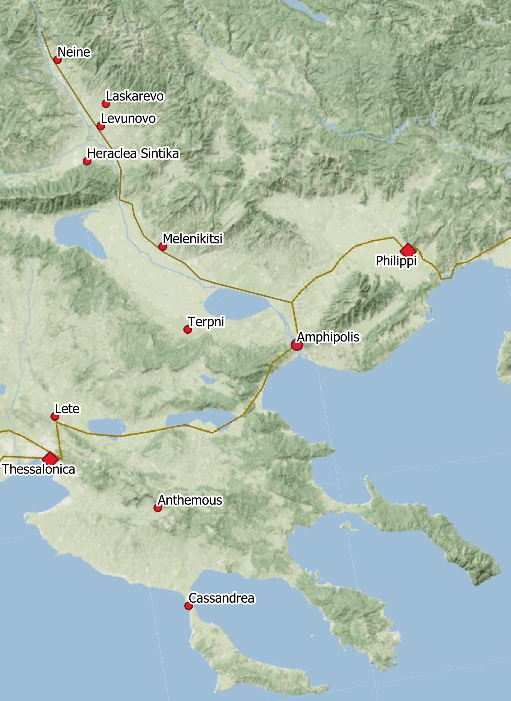
In the region of the Strymon valley, the Isiac cults are first attested at the port city of Amphipolis in the late 4th century BCE, in a funerary stela of a priestess of Isis, just a few years after the Piraeus inscription. [2] By the Roman times, the Isiac cults are attested in different parts of the city through inscriptions and statuettes hosting the cult of the Isiac triad – Isis, Serapis, and Anubis. [3] Interestingly, the presence of another divine figure of Egyptian origin has been attested in the city, the god called Totoes, Tutu, or Tithoes, an Egyptian deity rarely found outside Egypt and usually not associated with the Isiac cults [4] . Additionally, gods of Greek origin have been related to the Isiac gods, such as a relief representing Heracles and bearing an inscription towards Isis and Serapis [5] and the coins representing Artemis Tauropolos wearing a basileion, the typical headpiece of Isis. [6] It should be added that the Isiac cults in Amphipolis strongly relate to the sea, with evidence of the festival of Navigium Isidis inaugurating the navigating season [7] and a votive relief of a boat soon to be published.
Following the river Strymon in the Lower Strymon Valley, the Isiac presence is attested in two more sites that would be situated at the shores of the antique lake Kerkinitis. In Terpni, an inscription mentions the dedication of a temple to Horus-Harpocrates. [8] Further north, at a distance of 25 km from Terpni and 50 km from Amphipolis and at the east side of the Strymon, another settlement, today the small village of Melenikitsi, has revealed two reliefs, the first one representing a pair of footprints, commonly known as vestigia, and a second one representing an ear. Both have been related to the Isiac deities as symbols of the epiphany of the Isiac gods and of human-divine communication. Notably, this is a recurring pattern observed along the river as the footprints are also found in the Middle Strymon Valley; one attestation comes from the Lower and three from the Middle Strymon Valley. These symbols originated in Egypt and began spreading inland from principal harbors like Delos, Thessalonica, and Ostia during the second century BCE. In Macedonia, 16 such dedications have been identified, all dated to the Roman times. [9]
The early dating of the first findings and the large number of findings that persisted throughout the Roman period with artifacts indicating the presence of various gods belonging to the Isiac circle, as well as the fact that Amphipolis was an important port, has led to the suggestion that Amphipolis served as a key location, creating networks of connectivity with hinterland Macedonia and played an essential role in the local perception of the cult. [10]
At this point, understanding how these religious features reached these lands of the northern Aegean necessitates viewing the Hellenistic and Roman world as a cultural landscape interconnected by routes that adapted to geographical constraints. Mapping these landscapes unveils a network where cities and sites serve as hubs, emphasizing a distinction between social and spatial proximity. When closely studying such a network, it becomes evident that hubs with significant connections often occupy prominent and strategic positions in the natural landscape. Such is the case of the port of Amphipolis, facilitating its easy linkage with other nodes of the network.
Thus, it is important to discuss the critical location of Amphipolis and the role of the Strymon River in the dissemination of this cult. Amphipolis is situated approximately 5 km from the coast, in a protected bay, upon an eminence on the eastern bank of the Strymon below its egress from the ancient lake Kerkinitis. It stands in a pass that traverses the mountains bordering the Strymonic Gulf, and it commands the only accessible communication from the coast of that gulf into the great Macedonian plains. In its vicinity were the gold and silver mines of Mount Pangeon and extensive forests of ship-timber. A nearby ancient settlement called Ennea Hodoi, “Nine-Ways,” highlights exactly the city’s importance as a hub for traffic arteries. During the Hellenistic times, Amphipolis was a nodal port. Later on, the city became the capital of one of the four administrative and economic zones, with the new political order established by Aemilius Paulus after his victory in 168 BC. [11]
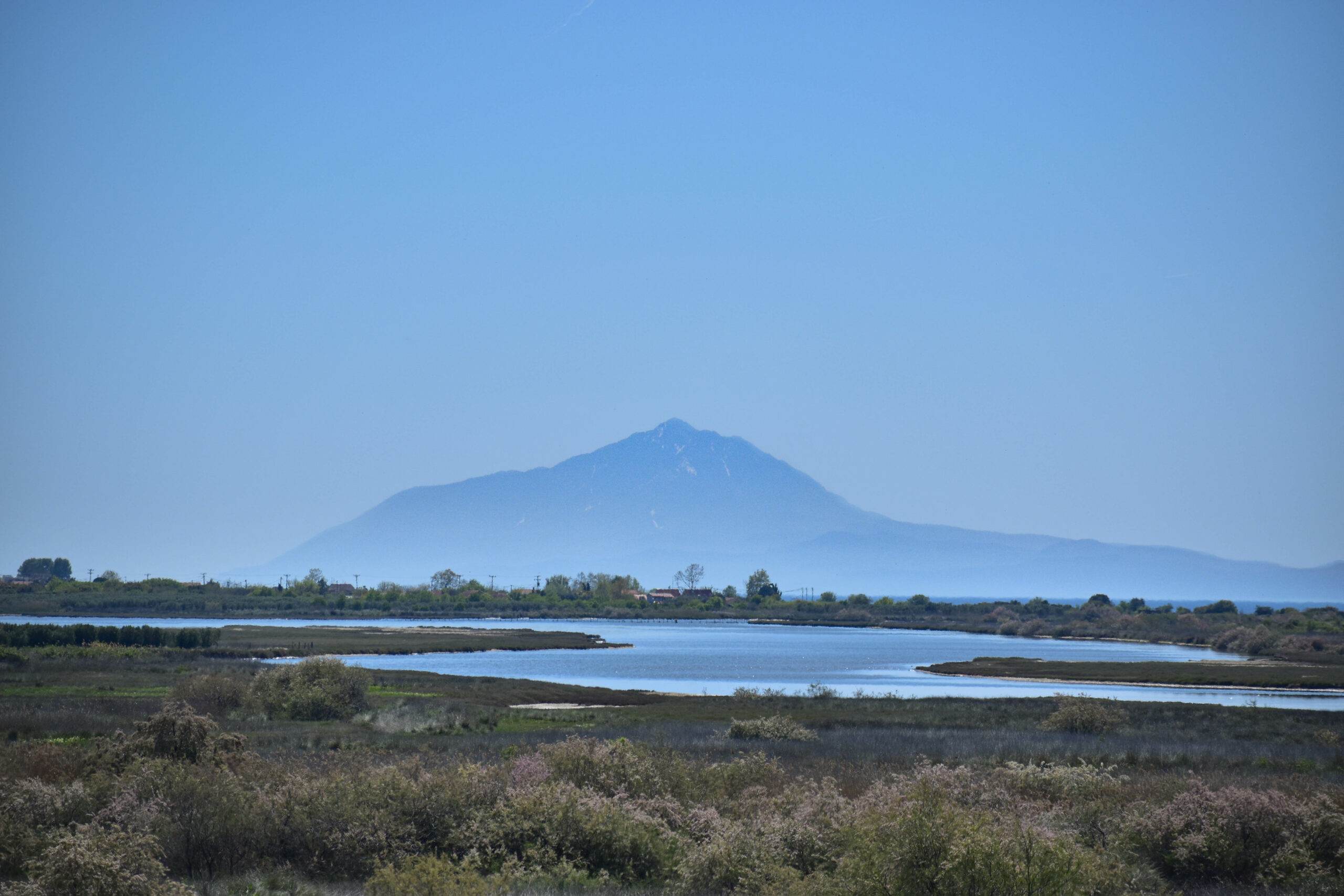
The Strymon, 392 km long with 122 km running in modern Greek territory in what we call the “Lower Strymon,” reaches the valley through a narrow pass in the eastern part of the Orvilos mountain chain and then flows to the gulf that bears its name. [12] Its gradually and constantly meandering route created the delta, marshlands, wetlands, and lakes, which formed a complex natural environment that also affected the human-made environment. A big debate is whether the Strymon was navigable and, if so, in which parts of its length. Researchers are not unanimous about whether the whole river was navigable or not. There is indirect evidence supporting all theories, but it is definitely to be considered that the Rupel Pass (today’s borders between Greece and Bulgaria) is a narrow passage, hemmed in by steep and rugged cliffs for the whole way. [13]
We should consider that riverine and maritime transportation was limited to certain seasons depending on the weather and the environmental conditions. Seasonal risks, including winter ice, spring and autumn floods, and summer drought, would dictate when and where a ship could travel carrying a specific weight. [14] Therefore, following geomorphological investigations that have shown that riverine traffic was constrained by the pattern of seasonal fluctuations in the water supply, it is concluded that bulk transports were likely limited to spring and autumn when the water flow was sufficient and calm. [15]
Following all the above, I argue that the river was a means of communication in the north-south axis, at least in specific periods of time and in some parts of it. We should not consider the whole river as a rigid entity classified in an absolute category of navigable or non-navigable rivers. It was a fluid agent that interacted with human agents in different ways due to the natural environment and weather conditions. Additionally, Roman planning linked rivers and roads. Living agents, materials, and information [16] would move along the north-south axis of the Strymon, either inside a boat or on a road by the river and through the mountain passes. Indeed, we know that several routes along the river Strymon, through the foothills, and the surrounding mountains would help the bidirectional movement of goods, demonstrating the variety and flexibility of regional exchange patterns that followed the more practical, easy, and cheap way to move around. [17]
In conclusion, the area embraced local, Thracian, and Panhellenic deities since earlier periods. However, during the Hellenistic and Roman periods, the influx of new gods from across the Mediterranean intensified through processes of globalization. [18] During this period, the Macedonian landscape emerges as a network of interconnected microregions [19] fostering various interactions among individuals. These interactions encompassed trade, work, worship, discourse, and more, contributing to disseminating religious features, practices, expressions, and ideas. The geographic features, the individual choices, and the distinct religious features shape the religious landscape of each city. Consequently, small events and individual choices gradually penetrated the local community, instigating changes spanning from social behaviors to material culture. Therefore, decisions such as permitting the construction of Isiac temples, welcoming iconographic types like Tithoes, adopting specific religious experiences, and dedicating the footprints in the Isiac sanctuaries were all influenced by the specific geographic, economic, social, cultural, or political factors inherent within the society where they occurred.
Images
Bibliography
Archibald, Z. H. 2016. “Moving Upcountry: Ancient Travel from Coastal Ports to Inland Harbours.” In Ancient Ports: The Geography of Connections, ed. K. Höghammar, B. Alroth, and A. Lindhagen, 37–64. Uppsala.
Bricault, L. 2005. Recueil Des Inscriptions Concernant Les Cultes Isiaques I. Paris.
———. 2008. Sylloge Nummorum Religionis Isiacae et Sarapiacae (SNRIS). Paris.
———. 2020. Isis Pelagia: Images, Names and Cults of a Goddess of the Seas. Leiden.
Casson, S. 1926. Macedonia, Thrace and Illyria: Their Relations to Greece from the Earliest Times Down to the Time of Philip Son of Amyntas. Oxford.
Christodoulou, P. 2009. “Priester Der Ägyptischen Götter in Makedonien.” Mitteilungen Des Deutschen Archäologischen Instituts Athenische Abteilung 124:325–56.
Farrington, A. 2008. “Η Ανατολική Μακεδονία κατά τους Ελληνιστικούς και Ρωμαϊκούς Χρόνους [Hê Anatolikê Makedonia kata tous Ellênistikous kai Rômaikous Chronous].” In Ανατολική Μακεδονία [Anatolikê Makedonia], ed. G. Papazoglou, 76–98. Komotini.
Fassa, E. 2019. “Experiencing the Divine as an Active Agent: Listening Gods and Their Aures in Graeco-Roman Macedonia.” The Journal of Epigraphic Studies 2:43–61.
Franconi, T. 2023. “The Environmental Context of Riverine Trade in the Roman World.” In Archaeology and Economy in the Ancient World, ed. M. Bentz and M. Heinzelmann, 231–4. Heidelberg.
Gasparini, V. 2021. “Isis’ Footprints. The Petrosomatoglyphs as Spacial Indicators of Human-Divine Encounters.” In SENSORIVM. The Senses in Roman Polytheism, ed. A. Alvar Nuño, J. Alvar Ezquerra, and G. Woolf, 272–365. Leiden.
Horden, P., and N. Purcell. 2000. The Corrupting Sea. A Study of Mediterranean History. Oxford.
Maikidou-Poutrino, D. 2021. The Isiac Cults in Roman Greece. Religious Connectivity in the Mainland, the Aegean and the Eastern Mediterranean. PhD diss., Aristotle University of Thessaloniki.
———. 2022. “The Πλοιαφέσια in the Greek Landscape: A Local Expression of a Global Festivity.” In Current Research in Egyptology 2021, ed. E. Apostola and C. Kekes, 173–89. Oxford.
Malaise, M. 2009. “Le Basileion, Une Couronne d’ Isis: Origine et Signification.” In Elkab and Beyond: Studies in Honour of Luc Limme, ed. C. Wouter, M. de Herman, and H. Stan, 439–55. Leuven.
Malama, P. 2022. “Der Fluss Strymon Und Die Hafen von Amphipolis.” In Mare Thracium, ed. T. Schmidts and I. Triantafillidis, 63–75. Mainz.
Mazurek, L. 2020. “Fashioning a Global Goddess: The Representation of Isis across Hellenistic Seascapes.” In Mediterranean Archaeologies of Insularity in an Age of Globalization, ed. A. Kouremenos and J. M. Gordon, 179–207. Oxford.
Pitts, M., and M. J. Versluys. 2014. Globalisation and the Roman World: World History, Connectivity and Material Culture. Cambridge.
Veymiers, R. 2009. “Les Cultes Isiaques à Amphipolis. Membra Disjecta.” Bulletin de Correspondance Hellénique 133:471–520.
Woolf, G. 2023. “The Roman Mediterranean as a Fluid System.” In Mediterranean Flows: People, Ideas and Objects in Motion, ed. A. Usacheva and E. Mataix, 1–16. Leiden.
Footnotes
[ back ] 1. Bricault 2005, 101/0101.
[ back ] 2. Veymiers 2009, 478.
[ back ] 3. On the findings from Amphipolis in general, see Veymiers 2009; Maikidou-Poutrino 2021, 105–21.
[ back ] 4. Maikidou-Poutrino 2021, 299–300.
[ back ] 5. Bricault 2005, 113/0906.
[ back ] 6. On the symbolism behind the use of the basielion in this case see Bricault 2008, 90; Veymiers 2009, 495–6. On the use of the basileion in general see Malaise 2009.
[ back ] 7. Bricault 2020, 220–1; Maikidou-Poutrino 2022, 177–8.
[ back ] 8. Christodoulou 2009, 334. On the inscription see Bricault 2005, 113/0905.
[ back ] 9. Maikidou-Poutrino 2021, 209–13. On the footprints see Gasparini 2021. On the ears see Fassa 2019.
[ back ] 10. Mazurek 2020, 181.
[ back ] 11. Malama 2022, 68–9.
[ back ] 12. Farrington 2008, 76.
[ back ] 13. Casson 1926, 19–20.
[ back ] 14. Franconi 2023.
[ back ] 15. Archibald 2016, 57.
[ back ] 16. On the movement of these categories see Woolf 2023, 3.
[ back ] 17. Archibald 2016, 58.
[ back ] 18. In general on globalization in the Roman period see Pitts and Versluys 2014.
[ back ] 19. Horden and Purcell 2000, 51–172.